If living on James Island means anything, it means planning your day by the tide. With the Stono River on one side, Wappoo Creek to the north, and Folly River to the south, you have great choices for launching, storing, or mooring your boat. The challenge is deciding which option fits your boat, your schedule, and your budget. In this guide, you’ll learn the local water routes, realistic drive times from key neighborhoods, and how to choose between public ramps, marinas, and dry‑stack. Let’s dive in.
Water access around James Island
James Island is ringed by tidal water. That gives you flexibility, but it also means you should plan around currents and depth.
Stono River basics
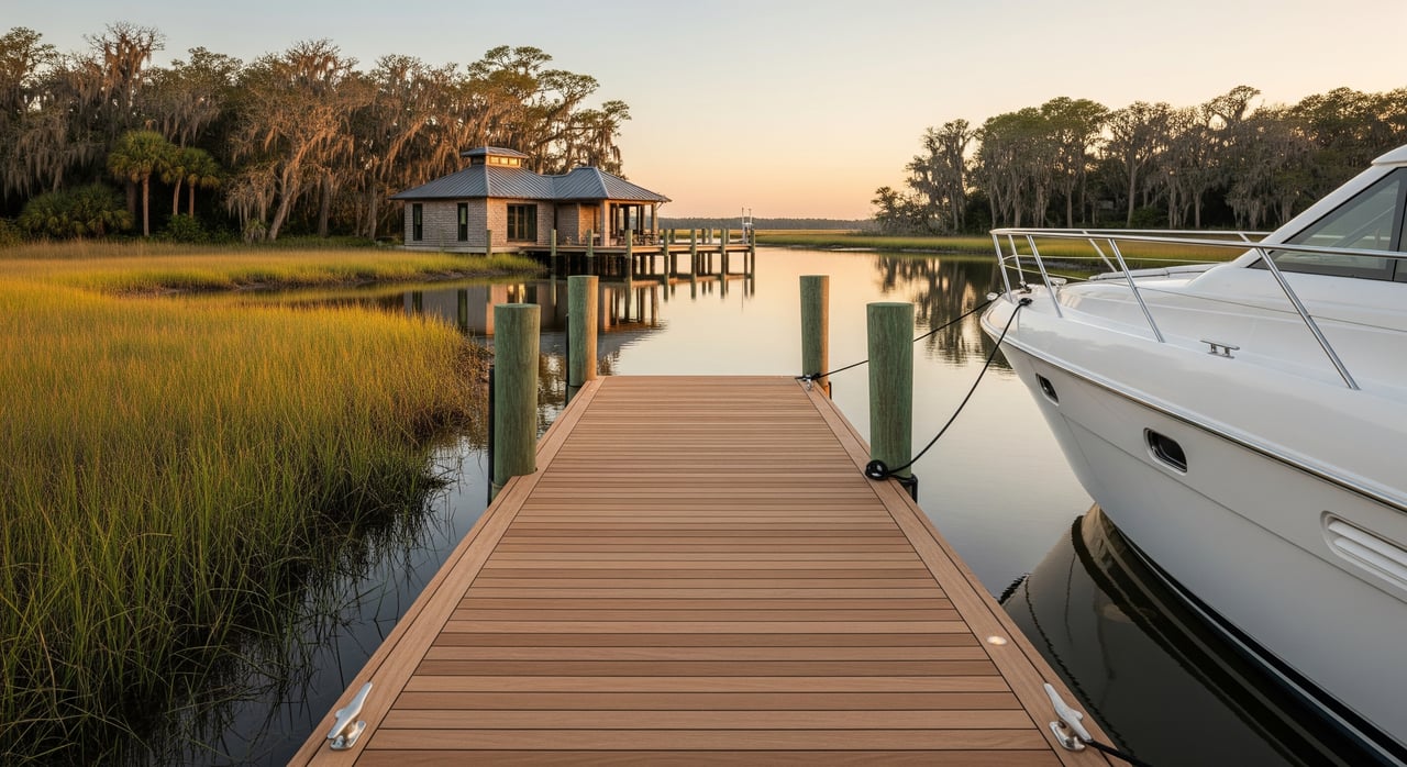
The Stono River runs along the west and southwest side of James Island. It connects to the Intracoastal and the Atlantic, so it is popular for cruising and fishing. The river is wide, yet tidal currents can be strong. Plan your launch and return with the tide in mind.
Wappoo Creek to the harbor
Wappoo Creek, also called Wappoo Cut, links the Ashley River to Charleston Harbor. From here, you can reach downtown marinas and deeper water. Clearances at bridges and your boat’s air draft matter, so confirm heights at mean high water before you go.
Folly River and tidal creeks
The Folly River and nearby creeks are scenic and convenient, but they are shallower and can shoal. If you run a deeper draft boat, time your trips closer to high tide and follow marked channels closely.
On‑island public launches
For quick, everyday access, on‑island ramps are hard to beat. They tend to be practical for trailered boats and smaller craft, and they keep your drive simple.
- Expect 5 to 15 minutes by car from most James Island neighborhoods during off‑peak times.
- Many small neighborhood launches allow only shallow‑draft boats and may have limited parking. Respect posted rules and resident‑only access.
- Plan around tidal range. Low water can reduce depth at the ramp and complicate retrieval, especially in narrow creeks.
Before you go, confirm ramp hours, parking rules, and any launch fees with the managing agency. In this area, that is often the City of Charleston, Charleston County Parks, or South Carolina DNR.
Folly Beach access points
If you want fast access to the Atlantic side, Folly Beach and the Folly River area can make sense.
- Good for anglers and day cruisers heading south and east.
- Channels can be shallow and change with the season, so slow down and stay inside markers.
- Expect a 10 to 20 minute drive from central James Island in typical traffic, a bit shorter from Secessionville and Sol Legare areas.
Weekends and holidays bring extra demand near Folly Beach. Arrive early, and have a backup plan if trailer parking fills.
Stono River and Johns Island marinas
For many boaters on James Island, marinas along the Stono River and Johns Island offer the best mix of depth, services, and convenience.
- Off‑peak drive times are usually 10 to 25 minutes, closer for Harborview, Riverland Terrace, and western James Island.
- These marinas often support larger boats, with slip options, fuel, pumpout, and sometimes haul‑out and repair.
- If you fish or cruise often, a slip here can reduce your run time to open water.
Call ahead for slip availability, draft limits at mean low water, power configurations, and insurance requirements. Policies and rates change with the season.
Downtown and Shem Creek marinas
If your top priority is easy access to Charleston Harbor and downtown amenities, look to marinas north via Wappoo Cut.
- Downtown marinas are typically 15 to 30 minutes by car from James Island in off‑peak traffic.
- Shem Creek marinas in Mount Pleasant are often 20 to 35 minutes by car. The trade‑off is quick harbor access and a lively dining scene.
- Charleston City Marina is a municipal option that serves both transient and long‑term slips close to downtown attractions.
Expect stronger currents around the harbor. Plan arrivals during favorable tide windows, especially for single‑engine or high‑windage boats.
Dry‑stack storage near James Island
Dry‑stack, also called rack storage, can be a smart middle ground if you want speed without the hassle of trailering.
- Typical facilities handle boats up to the mid‑30‑foot range, within weight limits. Always confirm your boat’s length, beam, and weight against the lift capacity.
- Launches are handled by staff, often within scheduled windows or via call‑ahead. Ask about cutoff times and weekend queues.
- Expect locations within a 15 to 30 minute drive of James Island, including Johns Island and areas near downtown marinas.
Dry‑stack can save wear on your trailer, reduce bottom maintenance, and make peak‑season weekends easier.
Decision checklist: launch vs marina vs dry‑stack
Use this quick checklist to match your boating style with the right option.
- Boat profile: length, beam, draft, air draft, weight
- Crew: how many hands you have for launch and retrieval
- Frequency: weekly, monthly, or seasonal use
- Storage: willingness to trailer and store at home, HOA rules, and driveway space
- Budget: launch fees, slip rates, or monthly dry‑stack costs
- Amenities: fuel, pumpout, power, restrooms, showers, Wi‑Fi, security
- Tides and currents: comfort level with strong currents and narrow ramps
- Bridge clearances: fixed bridge heights on your route, especially at high tide
- Insurance: documentation marinas require for slips or dry‑stack
- Maintenance: haul‑out access and service backlogs for routine work
Verify before you launch
Charleston’s waters are dynamic. A little prep makes the day smoother.
- Check NOAA tide predictions and current tables for your launch and return windows.
- Review the U.S. Coast Guard Local Notice to Mariners for temporary changes, restrictions, or bridge schedules.
- Use South Carolina DNR’s boating access resources to confirm public ramp status and rules.
- Call marinas directly to confirm depth at mean low water, slip sizes, and booking policies.
- Cross‑check user reports on reputable boating apps, then verify with the facility.
Pack lines, fenders, a spare plug, and a patient attitude at the ramp. Courtesy goes a long way on busy summer Saturdays.
Drive‑time cheat sheet by neighborhood
Use these typical off‑peak ranges to set expectations. Confirm for your exact address and the time of day.
- On‑island public ramps: usually 5 to 15 minutes from Harborview, Riverland Terrace, the Folly Road corridor, Secessionville, and Sol Legare.
- Stono River and Johns Island marinas: often 10 to 20 minutes from western James Island and Riverland Terrace, 15 to 25 minutes from Folly Road and Secessionville.
- Downtown Charleston marinas: commonly 15 to 30 minutes from most of James Island, depending on bridge traffic.
- Shem Creek marinas: generally 20 to 35 minutes, since you will route through downtown corridors.
- Folly Beach and Folly River access: about 10 to 20 minutes from central James Island, typically quicker from Secessionville and Sol Legare.
Use weekday evenings or early mornings for the least congestion, especially when towing.
Seasonal demand and booking tips
Charleston’s boating calendar has rhythms you can plan around.
- Peak demand hits summer weekends and holiday periods like Memorial Day, July Fourth, and Labor Day.
- Spring and fall see extra traffic for fishing and shrimping. Downtown events can also spike slip demand.
- For marinas and dry‑stack, reserve as early as possible for summer. For holiday weekends, months ahead is wise.
- For public ramps, arrive early, bring a launch‑ramp checklist, and stage your gear before you reach the water.
- Most marinas require proof of insurance and current registration for long‑term storage.
Keep an eye on seasonal shoaling reports and plan maintenance such as bottom paint and zinc changes ahead of the rush.
Mooring and anchoring notes
Public mooring fields are limited in this area. Many marinas prioritize slips or transient dockage. If you plan to anchor on the Stono River or in tidal creeks, learn the holding ground, give generous scope, and stay clear of channels. Always confirm local ordinances and no‑wake zones, and secure a safe dinghy landing plan.
What to gather when you call facilities
Use this simple template to capture the details you need for apples‑to‑apples comparisons.
- Facility type: public ramp, marina, transient dockage, dry‑stack, or boatyard
- Location: address and GPS, plus nearest channel or marker
- Water data: depth at mean low water, turning basin width, tide sensitivity
- Capacity: ramp lanes, trailer parking, slip sizes and beam, lift capacity for dry‑stack
- Services: fuel (gas or diesel), pumpout, shore power, restrooms, showers, Wi‑Fi, laundry, haul/repair
- Policies: reservations, insurance, liveaboard rules, launch cutoff times
- Costs: launch fee, day or overnight rates, monthly slip or rack ranges
- Demand: typical wait times and seasonal lead time to book
Keep your notes handy so you can pivot if Plan A is crowded.
Work with a local advisor
If easy water access is a must‑have for your next home, factor it into both your neighborhood search and your storage plan. From Harborview to Riverland Terrace, from Secessionville to Folly Beach, each area offers different drive‑time trade‑offs to ramps, marinas, and dry‑stack. You deserve a clear, personalized plan that matches how you actually boat.
If you want help mapping launch points and storage options to your short list of homes, reach out. With local, place‑based guidance and concierge coordination, Lisa Nicole Thornton can help you choose a home that fits your boating life.
FAQs
What waterways serve James Island boaters?
- The Stono River, Wappoo Creek that connects to Charleston Harbor, and the Folly River with nearby tidal creeks provide varied routes that require tide‑aware planning.
How long is the drive to downtown marinas from James Island?
- Typical off‑peak drive times range from about 15 to 30 minutes, depending on your neighborhood and bridge traffic conditions.
When should I launch to avoid ramp lines near James Island?
- Arrive early on weekends or use weekday evenings, and expect the longest lines on summer and holiday weekends like Memorial Day and July Fourth.
Is dry‑stack storage worth it around James Island?
- If you boat frequently on busy weekends and prefer not to trailer, dry‑stack offers fast launches, protection from the elements, and less maintenance trade‑offs.
Do I need to worry about tides and bridge clearances here?
- Yes, Charleston is strongly tidal, and you should confirm both water depth and fixed‑bridge heights at mean high water for your boat’s draft and air draft.
Can I anchor on the Stono River near James Island?
- You can anchor in suitable areas outside channels with proper scope, but confirm local ordinances, holding ground, and nearby no‑wake zones before you set the hook.
